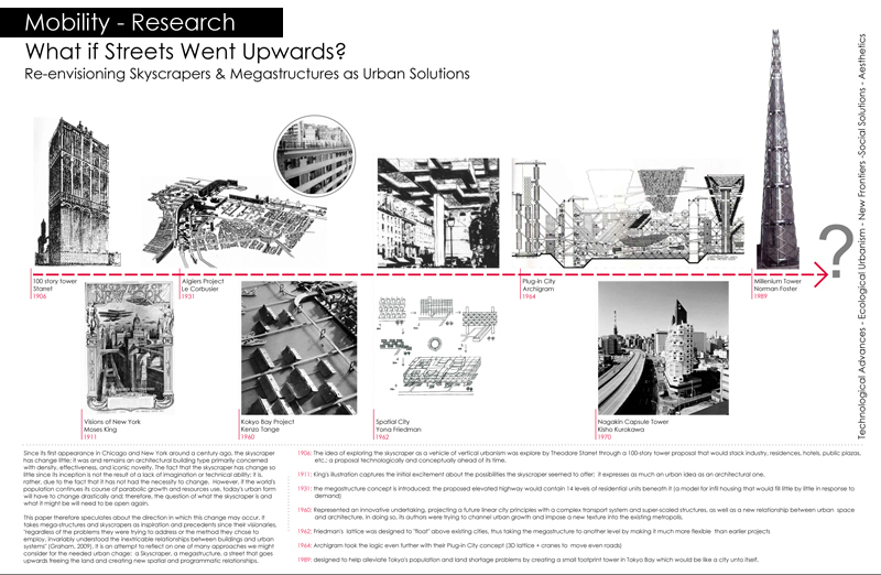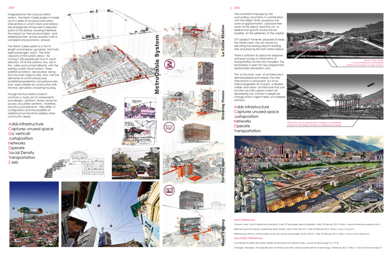
The drawings below were produced during the urban and landscape design studio entitled “Re-Envisioning Infrastructural Breaks: Urban and Landscape Design Strategies for the Southern Edge of Beirut’s Central District,” instructed by Profs. Robert Saliba and Hana Alamuddin at the American University of Beirut (graduate program in Urban Design, 2012 Spring semester). The main outcomes of the studio were the: (a) comprehension of the urban context through historical research, field investigation, community surveying, stakeholder analysis, and a critical understanding of the institutional and political background, (b) appraisal of the distinctive physical and spatial character of an urban segment through comparative visual surveys, the analysis of morphological evolution, and the skeletal structure underlying urban form in terms of streets and open spaces and their relationships to the built mass, (c) development of a set of comprehensive urban design guidelines for upgrading the public domain and framing the development of the private domain to contribute to the quality of urban life in the city, and (d) assessing the applicability of a design proposal with regards to social, institutional and economic considerations and the planning system that underlies the production and management of urban form.
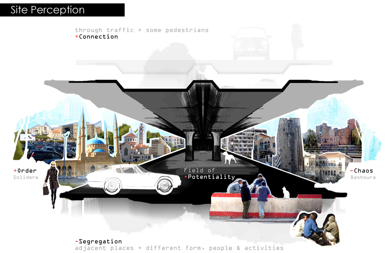
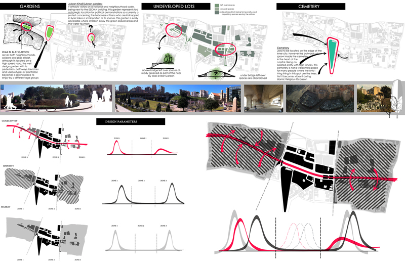
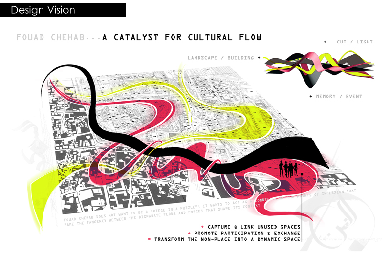
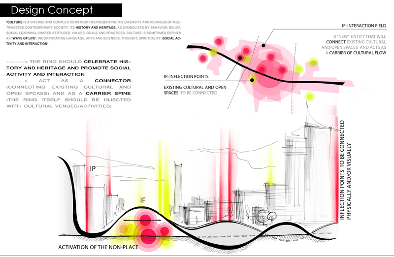
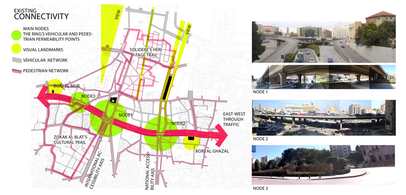
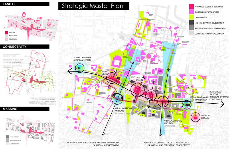
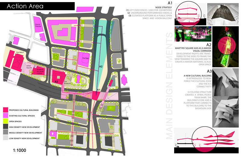
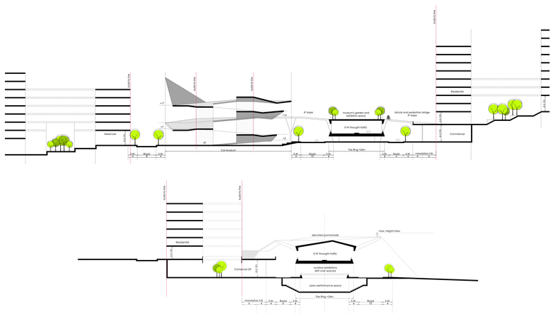
My intervention, “The Ring Road as Cultural Infrastructure,” was conceptualized along two main directions, longitudinal and transversal to include, respectively, linear design strategies introducing open and cultural spaces along the East-West axis of the highway and transversal design strategies reinforcing North-South interaction through the connection of heritage trails on both sides of the highway incorporating the planned Dar Beirut cultural center as a linking node along the way.